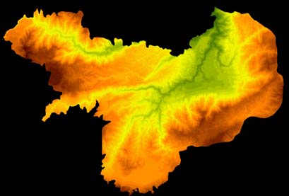
Figure 3.2. Elevations in the western survey zone.
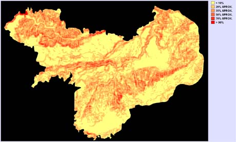
Figure 3.5. Slopes in the western survey zone.
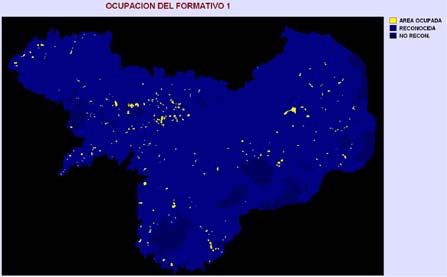
Figure 3.11. Distribution of Formative 1 occupation in the western survey zone.
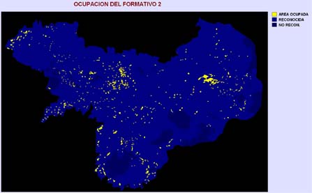
Figure 3.12. Distribution of Formative 2 occupation in the western survey zone.
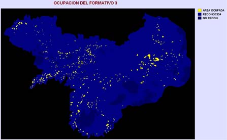
Figure 3.13. Distribution of Formative 3 occupation in the western survey zone.
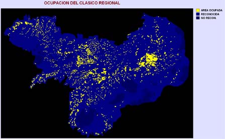
Figure 3.14. Distribution of Regional Classic occupation in the western survey zone.
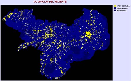
Figure 3.26. Distribution of Recent occupation in the western survey zone.
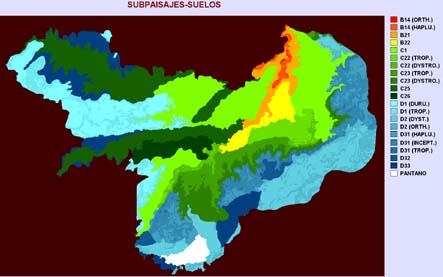
Figure 3.33. Soilscapes in the western survey zone.
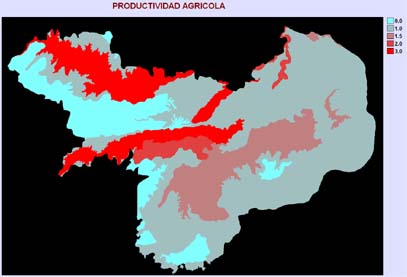
Figure 3.36. Distribution of agricultural productivity in the western survey zone.
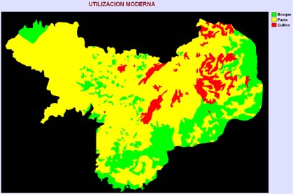
Figure 3.37. Distribution of modern land use in the western survey zone.
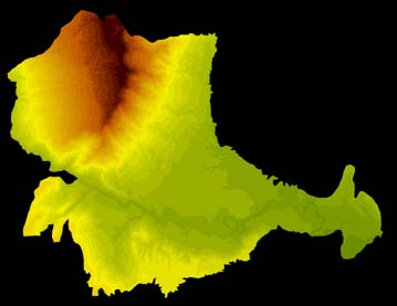
Figure 4.2. Elevations in the eastern survey zone.
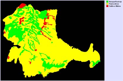
Figure 4.6. Distribution of modern land use in the eastern survey zone.
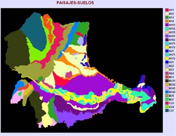
Figure 4.7. Soilscapes in the eastern survey zone.
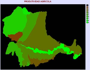
Figure 4.8. Distribution of agricultural productivity in the eastern survey zone.

Figure 4.10. Distribution of Formative 1 occupation in the eastern survey zone.
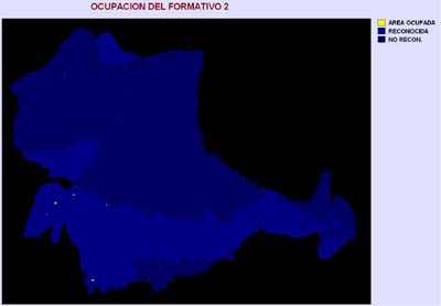
Figure 4.11. Distribution of Formative 2 occupation in the eastern survey zone.

Figure 4.12. Distribution of Formative 3 occupation in the eastern survey zone.

Figure 4.13. Distribution of Regional Classic occupation in the eastern survey zone.
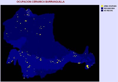
Figure 4.14. Distribution of Recent occupation (Barranquilla Buff ceramics) in the eastern survey zone.

Figure 4.15. Distribution of occupation indicated by Mirador Heavy Red ceramics in the eastern survey zone.

Figure 4.16. Distribution of occupation indicated by California Heavy Gray ceramics in the eastern survey zone.
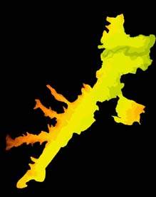
Figure 5.4. Elevations in the central survey zone.
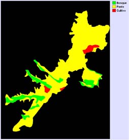
Figure 5.6. Distribution of modern land use in the central survey zone.
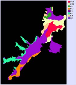
Figure 5.7. Soilscapes in the central survey zone.

Figure 5.8. Distribution of Formative 1 occupation in the central survey zone.
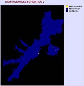
Figure 5.9. Distribution of Formative 2 occupation in the central survey zone.
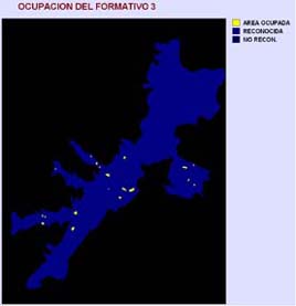
Figure 5.10. Distribution of Formative 3 occupation in the central survey zone.
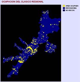
Figure 5.11. Distribution of Regional Classic occupation in the central survey zone.

Figure 5.12. Distribution of Recent occupation (Barranquilla Buff ceramics) in the central survey zone.
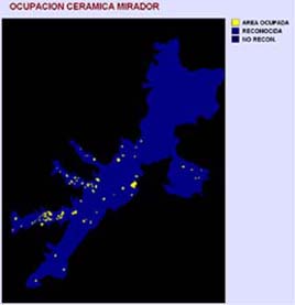
Figure 5.13. Distribution of occupation indicated by Mirador Heavy Red ceramics in the central survey zone.
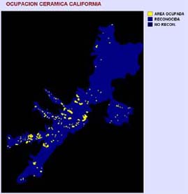
Figure 5.14. Distribution of occupation indicated by California Heavy Gray ceramics in the central survey zone.