|
Comparative Archaeology Database, University of Pittsburgh
|
|
Upper Daling Region Settlement Dataset |
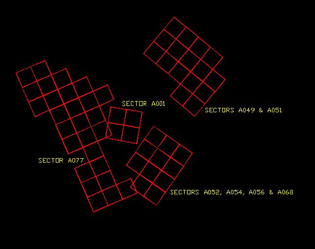
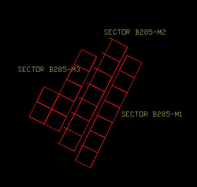
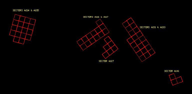
The magnetometer survey was carried out by Timothy Horsley in grid units 30 m by 30 m oriented as convenient to topography and field boundaries (see printed volume Chapter 3). These maps locate each 30 m grid unit, and label the different sectors into which they are grouped. Three maps are provided, one for each of the three areas of work (Dongshanzui, Sanjia, and Erbuchi). The maps are provided in vector format as a AutoCAD DXF files. In the files, an AutoCAD closed polyline delineates each grid unit. The individual sectors where more intensive work was carried out were numbered, and these designations are provided on these maps as well for locating the magnetometry results, which are labeled with these sector numbers.
Low-resolution preview of MAGDSZ.DXF |
Download the file MAGDSZ.DXF (43 KB). |
Low-resolution preview of MAGEBC.DXF |
Download the file MAGEBC.DXF (24 KB). |
Low-resolution preview of MAGSJ.DXF |
Download the file MAGSJ.DXF (45 KB). |